
Last Update: 06/03/2026 at 6:50 AM EST
Sea Level Risk Reassessment
Coverage from The Guardian, Nature, and others
Articles
15
Latest Article
05/22
Active Days
908
Executive Summary
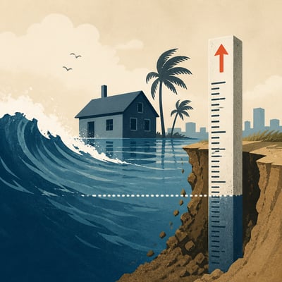
Recent research is revising coastal sea-level baselines upward, showing many studies have underestimated current shoreline water height and the number of people and places exposed to future inundation. The strongest signal is methodological rather than event-driven: measurement choices, datum mismatches, and incomplete coastal modeling are reshaping risk estimates. That interacts with broader evidence that sea level is rising and accelerating, with local impacts varying by subsidence, rebound, and regional ocean dynamics.
Key Points
- Multiple studies converge on the same finding: many coastal hazard assessments start from sea-level baselines that are too low by roughly 24 to 30 centimeters on average.
- Correcting those baselines expands estimated exposure, with some reports projecting up to 37 percent more coastal land below sea level and as many as 77 to 132 million additional people at risk.
- The largest discrepancies appear in the Global South, Southeast Asia, and the Indo-Pacific, where sparse tide-gauge coverage and local elevation issues make risk estimates less certain.
- The topic is increasingly about measurement and methodology, not just projected sea-level rise: geoid references, land elevation datasets, waves, tides, currents, and datum handling are all under scrutiny.
- Longer-running sea-level rise evidence remains consistent: global sea level is rising and accelerating, with ice-sheet and glacier melt now playing a larger role than thermal expansion alone.
- Local risk remains highly uneven because subsidence, post-glacial rebound, and regional ocean dynamics can amplify or offset global trends.
- A secondary research thread adds ecosystem implications, showing that seasonal sea-level variability can change intertidal exposure patterns and stress coastal habitats.
Featured Article
Researchers in Nature report that revised coastal sea level measurements show higher risks and greater populations exposed to future flooding.
Coverage Timeline: 908 Days
Hover over any logo to see coverage summary, click for full article.
Additional Articles
⭐⭐⭐⭐⭐
Researchers report higher sea level estimates worldwide, especially in the Indo-Pacific and global south, based on a synthesis of 385 studies through 2025.
Recent sea-level projections and conceptual modeling indicate increased seasonal variability could extend intertidal exposure durations, affecting coastal ecosystem resilience assessments.
Researchers analyze 385 sea level studies to show current measurements increase projected exposure worldwide.
International researchers attribute accelerating global sea level rise over 1960 to 2023 to ocean warming and increased Greenland and Antarctica melt, published in Science Advances.
Researchers reveal in 2024 that geoid based sea level estimates understate true heights, affecting coastal planning in California and other regions.
Nature study covering 2009-2025 shows global coastline data revisions raise sea level estimates worldwide.
Researchers reveal revised coastal baselines in a Nature study, increasing global inundation risk and prompting adaptation funding considerations.
Researchers publish on March 4 that sea level baselines bias coastal flood risk in Global South and Indo-Pacific.
Researchers revise coastal baselines and reveal higher sea level rise exposure for global coastal populations in a recent study.
Researchers reviewed coastal evolution knowledge and recommend integrated modeling, remote-sensing datasets, and standardized outputs to improve sea-level rise and storm impact forecasting for adaptation.
Scientists report accelerating global sea level rise with regional coastal risk projections to 2100.
NOAA and partner scientists report in the 2020s that accelerating global sea level rise, increasingly driven by ice loss, is heightening uneven coastal flooding and infrastructure risks worldwide, particularly along United States coastlines.
⭐⭐⭐
Coastal cities face increasing flooding risk as measured sea-level rise since 1992 combines with land subsidence in places such as Jakarta and Lagos.
A peer-reviewed synthesis of 385 sea-level studies argues most coastal risk estimates rely on models rather than measurements, altering reported exposure levels globally.