
 Climate
 Privacy
 Bob Dylan
 Drones
 Data Centers
 AI Governance
 2026 Maine Senate Race
Great Lakes Flood Risk Exposes Gaps
Coverage from The Guardian, ABC News, and others
Articles
8
Active Days
79
The Topic
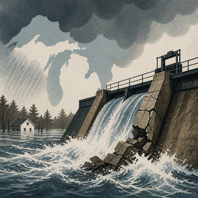
Spring 2026 flooding and severe storms across Michigan and Wisconsin exposed growing risks from heavier precipitation, rain falling on deep snow, and rapidly shifting seasonal conditions. Aging dams, culverts, roads, and stormwater systems were strained, while incomplete or outdated flood maps left many rural homeowners without clear risk information or insurance protection. The events are increasing pressure for better mapping, stronger preparedness, and investments in both engineered and nature-based flood resilience.
First Article: 04/06/26
Latest Article: 06/23/26
Summary
- Record spring snow and rainfall combined to produce widespread flooding across northern Michigan and parts of Wisconsin.
- Warmer conditions are contributing to heavier precipitation, earlier spring extremes, and more rain-on-snow runoff.
- Aging dams, culverts, roads, bridges, and stormwater systems were not designed for the current volume and intensity of water.
- Incomplete FEMA flood maps, especially in rural areas, left some affected properties outside designated flood zones.
- Flooding caused significant household, business, infrastructure, and public-sector losses, including evacuations and emergency declarations.
- Communities are considering wetlands, living shorelines, grassland restoration, and dedicated stormwater funding as resilience measures.
History
The story now emphasizes a broader, more concrete regional flood event with added damage and response details, including evacuations and emergency declarations. It also sharpens the framing around incomplete flood maps and the need for resilience investment, while dropping some earlier emphasis on insurance access and dam-failure history.
The story has broadened from general flood and infrastructure stress in Michigan and Wisconsin to a sharper focus on spring 2026 flooding exposing gaps in flood mapping, flood insurance access, and water-management capacity. It now also emphasizes specific resilience responses and renewed concern over prior dam failures.
Featured
Timeline: 79 Days
Hover over any logo to see coverage summary, click for full article.